- Air Homepage
- Weather Radar
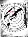
- Radar Site Weather
How is data processed at each radar site weather services use?
Find More about RADAR.
Weather forecasters can make quick forecasts using data from radar site weather display.
How do those magical weather forecasts work? Do you ever wonder how radar technology helps our meteorologists predict storms? We're about to take you on a whirlwind tour of weather-radar science.
With cutting-edge technology, weather forecasters can whip up quick forecasts in a flash. But who's the real star? Here's the radar! We can prep for Mother Nature's wildest moods with this superhero tech.
"How in the world do meteorologists make sense of those complex radar images?" That's the real adventure. Raindrops, airplanes, and yes, even swarms of insects bounce electromagnetic signals! In extreme weather, these signals help us figure out precipitation rates and storm paths.

We rely on math more than you'd expect to understand this techno-magic. Math turns radar images into meaningful forecasts. Have you heard of radar reflectivity? Precipitation intensity is like radar's superpower.
That's just the tip of the iceberg! There are advanced algorithms, exponential magic, and even superhero-named formulas. It's like watching a sci-fi movie unfold, except it's real.
🌦️ Let's talk tech. Computers help them interpret radar data. How? Maybe you're wondering...
Defeat Nature's Fury with Radar
Why Radar? By providing real-time information about precipitation patterns, weather radar helps people prepare for and stay safe during severe weather.
Detect violent systems, get a more complete picture of convection, and update warnings when time is of the essence. How do meteorologists make sense of these illustrations and radar weather images?
After coming out of the radar site, some electromagnetic signals are reflected by dense things in the air. They include falling precipitation, airplanes, swarms of insects, birds, etc.
With radar, we can see precipitation rates and patterns nearby. As well as predicting storm paths, it helps meteorologists identify dangerous storms. Radar systems can detect wind speed and direction, so we can prepare better for severe weather.
Precipitation gives us these weather pictures. Radar processing systems convert returned signal strength to precipitation intensity with advanced algorithms. How?
Through radar reflectivity, precipitation gives us weather pictures. Radar reflectivity measures how much radar signal is reflected back to the radar receiver by precipitation particles.
When the radar signal travels through the atmosphere, it encounters precipitation particles like raindrops, snowflakes, and hailstones. Some of the radar energy is reflected back to the radar receiver by these particles. Radar uses the returned signal strength to create a weather picture.
Meteorologists learn how to spot patterns in the picture so they can make sense of it. They can make short-term forecasts with enough study and do it quickly at a critical time.
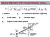
radar site weather - math conversions.
The conversion software makes a few technical assumptions about the beam and target. Then you translate reflectivity into precipitation rate with a crude mathematical formula.
Weather-radar-conversion math takes reflectivity into account. That means the ratio of reflected to broadcast signals.
After that, the computer applies an exponential algorithm. It depends on whether we're expecting rain or hail. It can be configured to show snow too. Most of the time we raise the signal quantity to a power between 1.5 and 2.5, depending on the conversion and sensitivity needed.
How Radar Decodes Storms
Radar processing systems convert returned signal strength into precipitation intensity using advanced algorithms that consider precipitation particle characteristics. To estimate precipitation intensity, these algorithms use signal processing techniques and mathematical models.

There's an algorithm called the Z-R relationship, which relates radar reflectivity (Z) to precipitation rate (R). According to this relationship, precipitation particle size and number are proportional to radar reflectivity.
In decibels (dBZ), reflectivity is the ratio of incoming reflected power flux to initial power sent out. Flux is the amount of energy that passes through an area in a specified amount of time.
Then it multiplies by a scaling constant, which depends on a lot of things. Often, these formulae carry the names of the researchers who devised them, like Marshall-Palmer (where perceived reflectivity is proportional to droplet diameter to the 6th power and dielectric constant squared of the targets squared, weighted by a drop size distribution) and Srivastave. They're not deadly accurate, but they're still useful.
While Marshall-Palmer measures the reflectivity of the targets based on the dielectric constant and the diameter of the droplets, the Srivastava algorithm calculates how many droplets there are.
Dual-polarization radar is another common algorithm. To figure out how precipitation particles are shaped, sized, and oriented, this algorithm uses two types of radar signals that are polarized differently. The intensity of precipitation is then estimated using this information.

#14
Search this site for more information now.
You might see special results at the top of the page, above the word WEB. They're ads, but they might be important to you. Happy searching!
Defining mathematics...
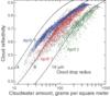
These are the values used by the U.S. government (NOAA) to convert radar site weather data into rain rates. One inch is 25 mm.

Here's something to note. Any increase of 10 on a decibel scale, starting with dB, means the reflected radiation is TEN TIMES stronger. It doesn't mean the storm is 10x stronger, just the incoming power. 🌪️
We are NOT Geeks
At least that's what some people think. Do you think math helps us to understand our world? Succeed at work? Use a computer?
You bet. That reminds me, it can help make you a better gambler if you're so inclined.
What's the most important thing math helps you with?
What Other Great Mathemeticians Have Said...
Click below to see contributions from other visitors to this page...
Producing Weather Forecasts Not rated yet
The literature gives a good description as to the systems used in monitoring the incoming weather. I do not believe that the information content is too …

MAthematical Precitions of Weather Not rated yet
I think the article is overly technical. It jumps straight into formulas or jargon right away and doesn't do an especially good job of giving these terms …
Interesting Not rated yet
This article was very interesting. It does get a little technical for lower grade levels, but anyone interested in Math from the higher high school grades …
Math's Pluses and Minuses Not rated yet
Well, math helps with a lot of things. For instance, it helps a mind more able to solve problems if it can convert a problem into a math problem. Different …
Very technical, a litle difficult to understand Not rated yet
This article is very technical. It talks about math but doesn't give very much information about the actual math involved. It talks about the formulae …
What if there are two storms in a row?
It's called attenuation. Storm chasers can't see the further cell on the weather radar because of the closer one. Below is an example.

We lose more power here because of increased absorption and scattering. Weather information on radar sites is reduced or even obfuscated in this case.
By using radar reflectivity, precipitation gives us weather pictures, and radar processing systems take the characteristics of precipitation particles into account to convert the returned signal strength into precipitation intensity.
Go back from Radar Site Weather to the Radar Real Time Weather webpage, or visit the Stuff in the Air homepage. It's free to get monthly weather science articles. ⛈️
Recent Articles
-
Canada is Too Cold.
Dec 30, 24 11:53 PM
By seeing how we adjust and handle our winters, you'll get to know this northern country and its curiosity, frustration, and confusion. Check out this -
Advanced Analytical Techniques for Monitoring Air Quality
Dec 27, 24 12:56 AM
 How to calibrate air quality monitors using the latest advanced analytical techniques. Learn about Least Square Regression, dynamic calibration and titration.
 -
Quality Assurance and Testing Services: Emission Monitoring Systems
Dec 24, 24 07:16 PM
Make your Continuous Emission Monitoring System accurate, reliable and penalty-free with gold-standard methods and quality assurance and testing services.

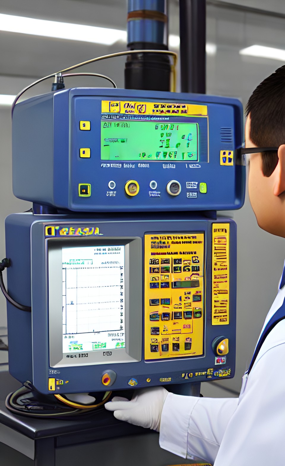
How does a radar site weather system work?
Weather detection equipment for radar sites. The presence of dense particles in the air is detected by a weather service provider and a precipitation detector.
Do you have concerns about air pollution in your area??
Perhaps modelling air pollution will provide the answers to your question.
That is what I do on a full-time basis. Find out if it is necessary for your project.
Have your Say...
on the StuffintheAir facebook page
Other topics listed in these guides:
The Stuff-in-the-Air Site Map
And,
Thank you to my research and writing assistants, ChatGPT and WordTune, as well as Wombo and others for the images.
GPT-4, OpenAI's large-scale language generation model (and others provided by Google and Meta), helped generate this text. As soon as draft language is generated, the author reviews, edits, and revises it to their own liking and is responsible for the content.
By Barry Lough, P.Met., EP (Environmental Professional)
Text copyright © 2003-2024 Stuff in the Air.com
BACK TO TOP - Hit your 'Home' Key
New! Comments
Do you like what you see here? Please let us know in the box below.