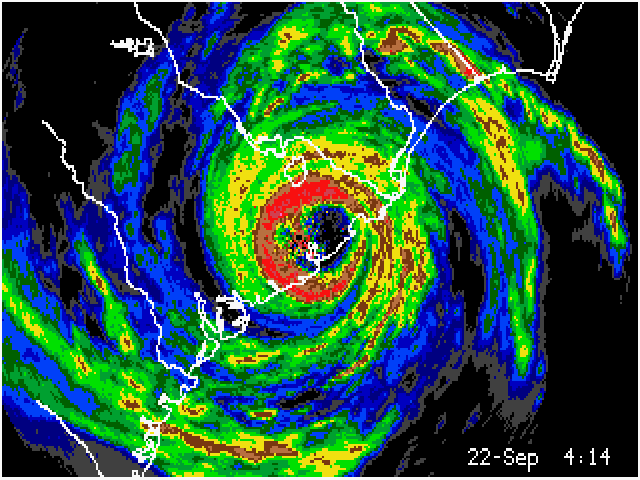
Radar
Radar is always interesting to look at. It is neat to look at when storms are brewing. A good place for forecast would be www.theweathernetwork.com. They always have up to date information and interesting stuff.
Barry's Response - Radar can also be art. It's very distinctive because of the colors. Thank you for your input.
Environment Canada operates a network of Radar sites as well. From this page https://weather.gc.ca/radar/index_e.html Canadians can select the one nearest yourselves. Weather Modification Inc. also has a radar in Olds that services Calgary and Red Deer. You can see it here during thunderstorm season (May to September): https://wmiradar.com/ahsp/index.php?type=loop&rad=mall&length=20&var=zdbzc.
Here's the USA NOAA radar mosaic page - https://radar.weather.gov/Conus/ for your reference.
Search this site for more information now.
With weather radar, you can to peer into Mother Nature's secret world, in which the unseen forces of weather are brought to life in mesmerizing colors and patterns.
Whether you're a weather enthusiast or just like the awe-inspiring beauty of nature, weather radar provides a captivating and informative experience. And it becomes a window into the ever-changing dance of atmospheric phenomena as storm clouds gather and lightning crackles.
Weather radar gives you real-time insight into how rain, snow, and storms move. A few clicks and you can see impending weather systems marching across the landscape. Foreseeing the skies' next move is like having a superpower!
Watching the vibrant hues on the screen, you realize weather consists of more than just a predictable science; it's a living, breathing thing. It captures the wild and untamed spirit of the weather, making you feel more connected to nature.
Here's how to get the most out of your radar:
- Different colors on the radar represent different intensities of precipitation. It's usually green when it's light rain, yellow when it's moderate rain, and red when it's heavy rain. It might be freezing rain or hail if it's pink or purple. You can tell how the weather will affect you by understanding these colors.
- Keep an eye on the timestamps on animated images to see how fast a storm is moving and when it might hit your location. For outdoor activities or shelter in case of bad weather, you'll find this information quite invaluable.
- Radar coverage can have gaps if obstructions like mountains or tall buildings interfere with signals. Especially in hilly or urban areas, keep this in mind when analyzing this data.
- Radar images that appear to show objects that aren't there are caused by anomalous propagation, when atmospheric conditions cause radar signals to travel further than usual. When radar signals pass through different layers of the atmosphere, their speed changes, causing this phenomenon.
Here are some fun facts about weather radar:
- Scientists repurposed weather radar after World War II to detect enemy aircraft.
- In modern radar, the "Doppler Effect" measures the movement of raindrops or particles in a storm which gives an indication of wind speed and direction. Meteorologists can detect rotation in severe thunderstorms, indicating tornado formation.
- A surplus World War II aircraft radar system was used to build the first weather radar in 1947.
The next time a storm brews, let the radar help you understand and appreciate the weather's ever-changing symphony. Have fun watching the radar!
Comments for Radar
|
||
|
||
|
||
|
||
Do you have concerns about air pollution in your area??
Perhaps modelling air pollution will provide the answers to your question.
That is what I do on a full-time basis. Find out if it is necessary for your project.
Have your Say...
on the StuffintheAir facebook page
Other topics listed in these guides:
The Stuff-in-the-Air Site Map
And,
Thank you to my research and writing assistants, ChatGPT and WordTune, as well as Wombo and others for the images.
OpenAI's large-scale language generation model (and others provided by Google and Meta), helped generate this text. As soon as draft language is generated, the author reviews, edits, and revises it to their own liking and is responsible for the content.


