- Air Homepage
- Satellites
- House Picture Satellite
Pixels to precision: The Evolution of House Picture Satellites
House picture satellite imagery has a bit of history.
Here's a chance to discover the fascinating history of satellite images capturing homes, from early California maps to Google Earth. You can also see how technology transformed Earth's surface, pixel by pixel. I'll cover the physics behind weather satellites and the small details captured by satellites. Today, satellite images help track environmental changes and plan for disaster relief.
There's a little history to satellite photos of houses. You'd have seen your high resolution photo online first if you lived in the States. A satellite photo of your house was a new and thrilling thing before Google Earth and other modern internet satellite photo services.
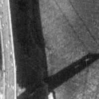
When this webpage was first published in 2003, the image on the right was state-of-the-art. Probably more than all the weather satellites combined, but who knows for sure? Using the California maps service, you could see the Golden Gate Bridge and individual cars. For its time, the resolution was amazing. Then came Google.
The Google Earth software and the online version at https://maps.google.com/ provide maps all over the world since 2005. Previously, satellite imagery was used for meteorology and other specialty purposes, not for fun or making everyday maps. Satellite technology needed a lot of pixels to make the details visible on the earth picture.
Satellite imagery has been used in Google Earth since the early 2000s. Keyhole was a company that developed a technology for interactive 3D maps using satellite imagery that Google bought in 2004. Users can explore the Earth's surface in detail with Google Earth, a virtual globe made by Google.
Google Earth uses satellite imagery from NASA, the European Space Agency, and commercial satellite companies like DigitalGlobe. Satellites collect images of the Earth's surface and then process and stitch them together to make a seamless, high-resolution map.
Google Earth's key innovation was the ability to stream satellite imagery over the internet, letting users explore the world in real-time without having to download a lot of data. As Google has improved its satellite imagery over the years, it has also added features like 3D models, street view, and historical imagery that show how the Earth has changed.
Google Earth is used by millions of people around the world for everything from exploring remote locations to conducting scientific research. Satellite imagery has also been used to track environmental changes, support disaster relief efforts, and even solve crimes.
House Picture Satellite from Space?
How do pixels work? Here's a few basics.
Video images are built from tiny points of light. It's just like on your computer screen.
Picture element is what they're called and this has been shortened to pixel. In the house picture satellite example above, the digital camera pixels are tiny compared to the weather equipment described below.
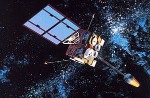
Video images are also produced by weather satellites. It takes a lot of data. Data keeps growing exponentially with ever-increasing resolutions. However, the physics is still the same.
Each pixel on a weather satellite display still shows a representative temperature (or other variable) for a huge area below. Although the satellite depictions aren't fine enough to see your house, they're great for things like synoptic systems and weather. Plus, they can tell a few things apart.
A lake, cloud or snow patch, for example, that's smaller than a pixel will change the colour slightly, but that's about it.
The bigger the item, the easier it is to see. Special duty: Here's where the data concentration comes in. In any recording, video, audio, or otherwise, resolution defines how much detail is available. Inch to pixels or kilometres per pixel are scale units.
For something much smaller, special equipment is needed to see it.
Satellite images provided by NOAA
There's a lot of fluctuation in satellite resolution. Geostationary equipment thousands of miles above the earth works best with visible light spectrum wavelengths. One pixel from a GEOS satellite positioned over 22 thousand miles above the earth is about a thousand metres square on the equator.
For more distant points on the earth (like the poles), the minimum size will double, thus corresponding to half-resolution. Both north and south, the camera can produce satellite images up to 70 degrees latitude.
IR infrared and water vapour resolutions use longer wavelengths and have poorer resolutions - eight and fourteen times worse than visible spectrums. Still, they're useful. They provide information of a different kind.
The NOAA polar orbiting satellites fly closer to the earth. Because of this, they have better resolution. For all wavelength channels, their squares are more like 1 km. Above, we used U.S. Geological Survey data, not NOAA. The satellites that provide imagery to Google, Bing, and so on are even better.
They also do color photography. Have a look at the
NOAA satellite images
main page here.
The average home is about 20 meters long. In order to see this clearly, satellite pixels need to be smaller than this, much smaller than the ones on the current weather satellites. This technology will keep getting better as photographic resolutions improve and data storage and transfer become cheaper.
What is the quality of the house picture satellite? Is it good enough to see your house from space?
Resolution: Satellite photos must be able to display great detail from a great distance above your house in order for you to see your house in detail.
Do you have concerns about air pollution in your area??
Perhaps modelling air pollution will provide the answers to your question.
That is what I do on a full-time basis. Find out if it is necessary for your project.
Have your Say...
on the StuffintheAir facebook page
Other topics listed in these guides:
The Stuff-in-the-Air Site Map
And,
Thank you to my research and writing assistants, ChatGPT and WordTune, as well as Wombo and others for the images.
GPT-4, OpenAI's large-scale language generation model (and others provided by Google and Meta), helped generate this text. As soon as draft language is generated, the author reviews, edits, and revises it to their own liking and is responsible for the content.


New! Comments
Do you like what you see here? Please let us know in the box below.